How to 3D print your Strava run or ride
Export the activity from Strava as a GPX file and upload it to Route to STL. You get a 3D-printable map with your route raised in its own colour over the streets, buildings and hills around it. It's free, and the file stays on your device.
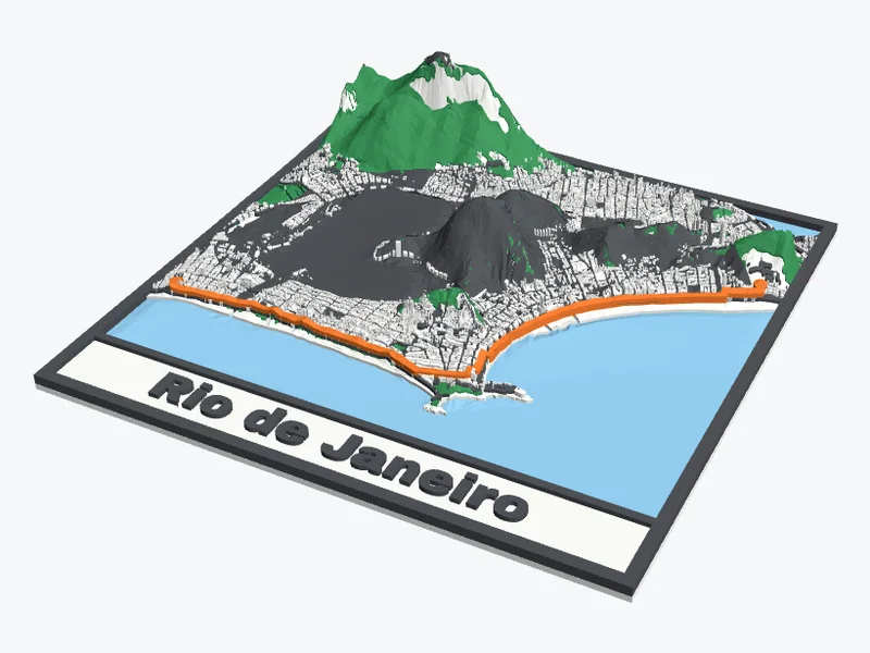
1. Get the GPX file
- Strava: open the activity on strava.com (the phone app can't export), click the ⋯ button and choose Export GPX. On a phone, open strava.com in the browser and ask for the desktop site.
- Garmin Connect: open the activity on connect.garmin.com, click the gear icon and choose Export to GPX.
- Komoot: open the tour on komoot.com, click ⋯ and choose Download GPX.
- Apple Watch: Apple's Fitness app can't export GPX. A free app such as RunGap or HealthFit saves the workout as a GPX file.
- Other apps (Wahoo, Suunto, Coros, Polar): look for Export or Share in the activity and choose GPX. A FIT or TCX file won't work.
No file? Choose Draw it on the map in Route to STL and click along the streets you went.
2. Make the map
- Open Route to STL and press Upload a GPX file. The map moves and zooms so the whole route fits.
- Make the area bigger if you want more of the town around it. Up to 10 km across the map shows every building; a longer route, up to 30 km across, keeps the main roads, railways, water and parks.
- Choose the shape, the width of the print and what you're making: a wall map, a coaster, a keychain or an ornament.
- Add the name of the run and your time as text, for example "Lisbon Half 2026 · 1:47:12".
- Press Make my 3D map, turn it around in 3D, and download the 3MF or STL.
Which size for which route?
| Route | Area across | What's on the map |
|---|---|---|
| A 5 km park run | 1.5 to 3 km | Every building and street around the route |
| A 10 km or half marathon | 4 to 10 km | Buildings, streets and the shape of the town |
| A marathon or a long ride | 10 to 30 km | Main roads, railways, water and parks, no buildings |
| A mountain climb | 5 to 15 km | The hills switch on by themselves; make them taller with the slider |
Printing it
- Multi-colour printer (AMS, MMU or a toolchanger): the route gets its own filament. Orange or red on a white or grey map stands out best.
- Filament swaps on any printer: the route stands 0.8 mm above the frame, so it shares the top colour with the frame and the text. See how to change filament at a layer.
- 0.2 mm layers, a 0.4 mm nozzle, 2 walls and 15% infill. No supports.
- Make the route wider (up to 4 mm) for a small print such as a keychain, so it prints as a solid line.
Good to know
Does my GPX file get uploaded?
No. The file is read in your browser and stays on your device. Only the map data of the area around it is loaded, from OpenStreetMap's open map tiles.
My route starts at my front door. Can I hide that?
Yes. Draw the route yourself and start it a few streets away, or leave out the start when you share a photo. The map itself is only on your device until you share the file or the link.
Can I print a route I didn't run myself, as a gift?
Yes. Ask the runner for the GPX file, use the GPX that many races publish on their website, or draw the course on the map.
Is it free?
Yes: no account, no download limit and no watermark.
Upload your GPX and see your route in 3D before you download. Free, no account needed.
Open Route to STLStrava, Garmin Connect, Komoot and Apple Watch are trademarks of their owners; Shapekit isn't connected to them. Map data © OpenStreetMap contributors.